The city of FORTALEZA- CEARÁ-Brazil
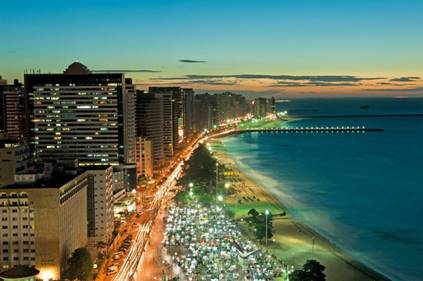
Fortaleza is a large city, with more than 2.5 million inhabitants is attractive day and night, and in five or six days you know the main points of interest of the region. Whether for sightseeing, enjoying the sea, the local culture or its beautiful restaurants, Fortaleza impresses with the enormous variety of activities.

The city of Fortaleza, the capital of the state of Ceará and the 5th largest in the country, is the closest Brazilian capital to Europe (5,608 km from Lisbon, Portugal) and is just 5,566 km from Miami (United States). Its strategic geographic position caused it to be the main point of transfer (input and output) of data from high traffic information from Brazil to the other four continents.
With This, today, all data traffic between Latin America and the rest of the world Passes through Fortaleza, which means that the city is responsible for connecting the Brazil to the world.

In Its 314,930 km2 of total area live 2,452,185 inhabitants (census 2010/IBGE). In addition to this number, the population of the other component municipalities in the region Metropolitan Fortress (RMF), the total number of inhabitants reaches the 3,818,380, Sufficient to be considered a “megalopolis”, with all the advantages and Difficulties arising from this condition.
The Municipal Human Development Index-2010 (IDHM 2010) is 0.732, which places the metropolitan region of Fortaleza In the 17th ranking of the HDI of the metropolises of the country. This index situates the Municipality in the high Human development range (IDHM between 0.700 and 0.799).
The Indices that most contributed to the high HDI of the municipality were those of the Longevity, with an index of 0.814, followed by income, with an index of 0.716, and Education, with an index of 0.672.
Fortress is divided administratively into seven regional executive secretaries, which They go from I to VI plus the Regional Center (cercefor). These regionals currently house 119 neighborhoods in five districts that, Historically, were isolated villages or even ancient municipalities that were Incorporated into the capital due to the expansion of the municipality’s boundaries. Was What happened to former municipalities of Parangaba and Messejana. Since 1997 the executive administration of the Fortaleza City Hall is divided into regional.
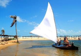
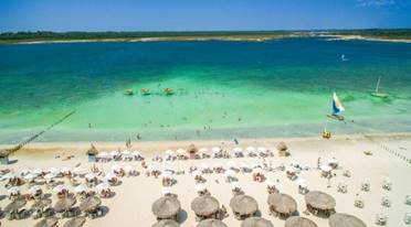
The Coast
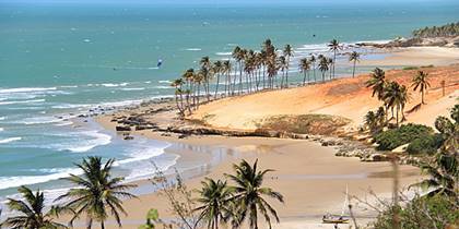
The Coast of Fortaleza has an extension of 34 kilometers, with a total of 15 Main beaches. It has as limits the mouth of the rivers Ceará, to the north, and Pacoti, to the south.
The Beaches most frequayed by locals are: Praia do Futuro (east), Meireles, Mucuripe and Iracema Beach (north), East-west and Barra do Ceará (west).
Access
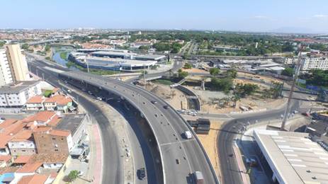
The CE-040 connects Capital to major tourist destinations located on the Costa do Rising Sun. For the Costa do Sol, the CE-085 or structuring highway, leads Visitors to São Gonçalo do Amarante (Pecém/Porto and Taíba), Paraipaba (Lagoinha beach) to Itapipoca (Whale Beach). The BR-020 connects Fortaleza to the central region of the state, which Its turn gives access to Serra da Ibiapaba and Sertão of Inhamuns.
The BR-116, the largest fully paved highway in the country, with approximately 4,513 Kilometers and passing through ten states, begins in Fortaleza and ends in City of Jaguarão, in the state of Rio Grande do Sul, on the border with the Uruguay.
For Through the sea, the visitor can reach Fortaleza by the Port of Fortaleza, Located in the beautiful Mucuripe Cove. He was Recently adapted to receive sea cruises that visit the coast Brazilian.
To The tourist, the advantage is the location of the port as it is less than 10 minutes For the best beaches in Fortaleza the main shopping centers and the region Hotel in the city.
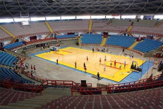
Gym PAULO Sarasate Sports
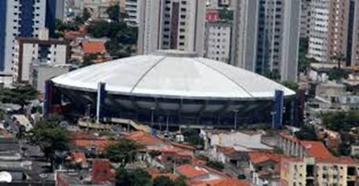
The gym Paulo Sarasate is a Brazilian gymnasium, Located in Fortaleza, Ceará. It belongs to the city hall of Fortaleza. In it works the secretariat of Sport and leisure of Fortaleza, responsible organ By your administration. It has total current capacity for 15,100 spectators, Being 7,308 seats in the upper bleachers, 6,475 seats in the chairs and 40 Places reserved for PCD.
The City of Fortaleza, capital of the state of Ceará and 5th largest in the country, is the capital Brazilian closest to Europe (5,608 km from Lisbon, Portugal) and is just 5,566 km from Miami (United States). Your Strategic geographical position caused it to be the main point of Transfer (inbound and outbound) of data from high traffic information from Brazil For the other four continents.
With This, today, all data traffic between Latin America and the rest of the world Passes through Fortaleza, which means that the city is responsible for connecting the Brazil to the world.
In Its 314,930 km2 of total area live 2,452,185 inhabitants (census 2010/IBGE). In addition to this number, the population of the other component municipalities in the region Metropolitan Fortress (RMF), the total number of inhabitants reaches the 3,818,380, Sufficient to be considered a “megalopolis”, with all the advantages and Difficulties arising from this condition.
The Municipal Human Development Index-2010 (IDHM 2010) is 0.732, which places the metropolitan region of Fortaleza In the 17th ranking of the HDI of the metropolises of the country. This index situates the Municipality in the high Human development range (IDHM between 0.700 and 0.799).
The Indices that most contributed to the high HDI of the municipality were those of the Longevity, with an index of 0.814, followed by income, with an index of 0.716, and Education, with an index of 0.672.
Fortress is divided administratively into seven regional executive secretaries, which They go from I to VI plus the Regional Center (cercefor). These regionals currently house 119 neighborhoods in five districts that, Historically, were isolated villages or even ancient municipalities that were Incorporated into the capital due to the expansion of the municipality’s boundaries. Was What happened to former municipalities of Parangaba and Messejana. Since 1997 the executive administration of the Fortaleza City Hall is divided into regional.